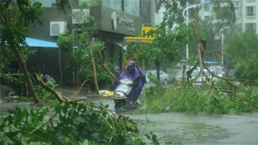
Tropical depression gains strength in Truong Sa Islands

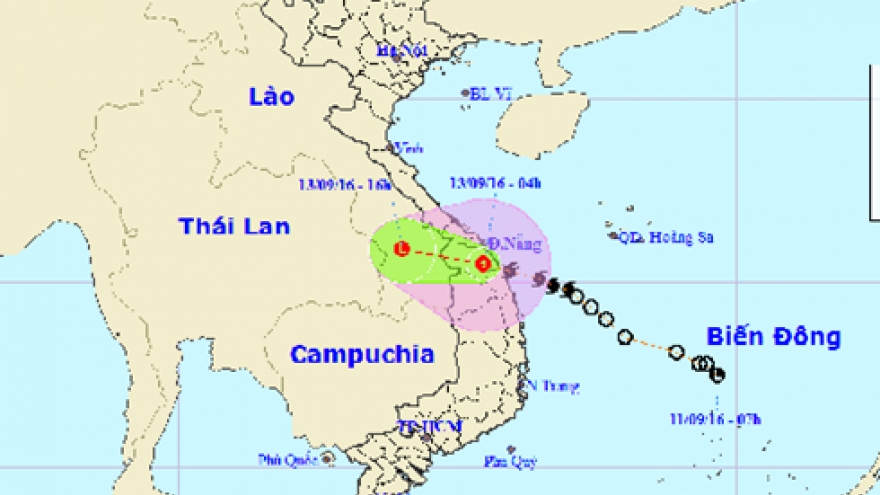
VOV.VN - The National Centre for Hydro-Meteorological Forecasting announced on November 4 that a tropical depression is located at 9.3 degrees north latitude and 110.5 degrees east longitude in the western waters of Truong Sa archipelago.
 |
It has maximum sustained wind speeds of 40-50km per hour and is tracking west and northwest at a speed of 15km per hour.
As of 1pm on November 5, the tropical pressure zone was located at 10.9 degrees north latitude and 107.7 degrees east longitude in the coastal areas of provinces of Binh Thuan and Ba Ria Vung Tau.
The tropical depression has also caused strong winds, thunderstorms and rough seas in the waters offshore the province of Ninh Thuan and Ba Ria Vung Tau. The Centre forecast that it will continue to strengthen over the next 24 hours.