Hanoi unveils unprecedented interregional transport network plan

VOV.VN - Hanoi has announced an ambitious new master plan featuring large-scale interregional transport corridors and railway systems designed to reshape the capital’s long-term development landscape.
Under the newly approved master plan, strategic development corridors will serve as major connectivity frameworks linking Hanoi with northern provinces, coastal regions and the northwestern areas of Vietnam.
Northern corridor to connect Hanoi with border gate regions

In the north, Hanoi plans to develop urban growth spaces along the Nhat Tan–Noi Bai and Bac Thang Long–Noi Bai axes.
The northern corridor is expected to connect central Hanoi with urban areas such as Vinh Yen, Song Cong and Thai Nguyen before extending toward northern mountainous provinces and border gate regions.
According to the planning strategy, this corridor will focus heavily on urban expansion, high technology, logistics, electronics manufacturing and semiconductor industries.
The Nhat Tan–Noi Bai axis will continue serving as a major international gateway and one of Hanoi’s new development backbones.
Southern growth corridor linked to future second airport
To the south, development space will expand along National Highway 1A, the national railway system and the North–South Expressway corridor.
This southern corridor will connect the city centre with Thuong Tin, Phu Xuyen and the site of Hanoi’s planned second airport.
Under the plan, Phu Xuyen is expected to emerge as a new industrial and logistics hub while strengthening connections with Phu Ly, Ninh Binh, Thanh Hoa and other provinces southward.
Urban planning experts believe the corridor could become a new economic growth axis capable of easing pressure on Hanoi’s inner districts. At the same time, it could create additional space for industrial and logistics development south of the capital.
East–West Corridor to link Hai Phong and Hoa Lac
Hanoi is also planning a major East–West development corridor connecting eastern growth poles with western urban centres.
The corridor will include the West Lake–Co Loa–Gia Binh Airport axis and National Highway 5 toward Hai Phong and Quang Ninh in the east. It will link to Thang Long Boulevard, the West Lake–Ba Vi axis and Hoa Lac urban area in the west.
According to the master plan, the East–West corridor will become a strategic development route connecting Hanoi with Phu Tho, Son La and the northern midland and mountainous regions.
Areas along the corridor are expected to host innovation-driven urban zones, logistics centres, high-tech industries and large-scale service hubs.
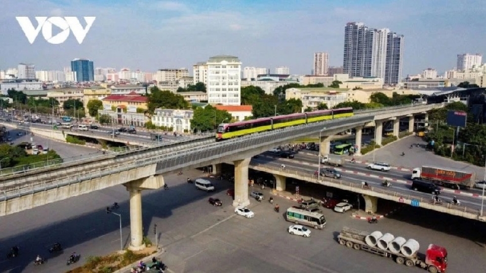
Hanoi to develop “2 rings – 7 lines” regional railway network
One of the most notable features of the new plan is the proposed “2 Rings – 7 Lines” interregional railway system.
Under the strategy, high-speed radial railway lines will connect with circular railway routes following Hanoi’s ring roads, creating a large-capacity transport framework for the broader capital region.
The network is intended to redirect interregional traffic away from the historic urban core and reduce congestion in central districts.
Hanoi also plans to establish railway ring connections linking Noi Bai Airport, Gia Binh Airport and the planned southern airport, forming a key transit hub for the national railway system.
According to the plan, intersections between railway lines and radial transport corridors will be developed under a transit-oriented development (TOD) model, creating new urban growth centres centred around public transport infrastructure.
During the initial phase, Hanoi is expected to prioritise investment in the northern-eastern-southern ring section connecting Noi Bai, Dong Anh, Gia Lam, Hung Yen, Phu Xuyen, Hoa Lac and Son Tay to reduce interregional traffic pressure on the city centre.
Hanoi approves capital master plan with 100-year vision
VOV.VN - Chairman of the Hanoi People’s Committee Chairman Vu Dai Thang signed a decision on May 13, 2026 approving the Hanoi Capital Master Plan with a 100-year vision, outlining development under an open urban model with a “multi-layered, multi-polar and multi-centered” structure, with the Red River serving as the city’s main ecological and cultural landscape axis.


