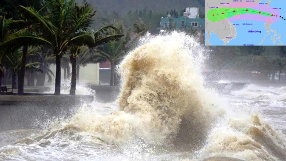
Super Typhoon Ragasa weakening but remains powerful

VOV.VN - Ragasa, the ninth storm to hit the East Sea this year, is likely to weaken before entering the Gulf of Tonkin, but the typhoon still poses major risks with strong winds, high waves, and heavy rainfall forecast for northern and north-central Vietnam.

At a meeting on storm response at the National Center for Hydro-Meteorological Forecasting chaired by Deputy Minister of Agriculture and Environment Nguyen Hoang Hiep on September 23, meteorologists assessed that Super Typhoon Ragasa is likely to weaken significantly before entering the Gulf of Tonkin. The meeting was
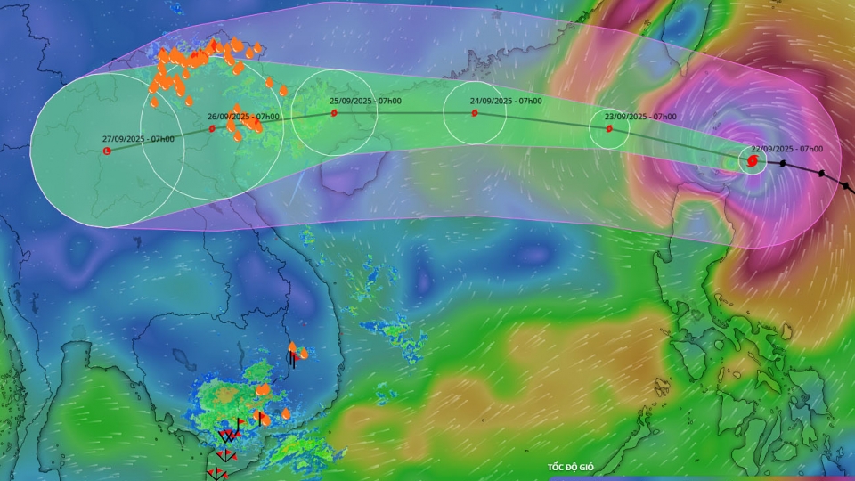
Reporting at the meeting, Mai Van Khiem, Director of the National Center for Hydro-Meteorological Forecasting said, “There are multiple scenarios for the track, intensity, and affected areas, but the most likely path is that Ragasa will veer north. Due to the influence of a cold air mass and friction while moving over China, the storm will likely weaken before reaching the Gulf of Tonkin.”
According to Khiem, by the time it enters the northern Gulf of Tonkin, Ragasa will weaken to levels 10–12 (90-120 kph), then further down to 8-9 (60-90 kph), and peak at around level 10 (around 90 kph) when making landfall on the coast from from northern Quang Ninh province to northern Thanh Hoa province.
Sharing the same assessment, Pham Thi Thanh Nga, Director of the Institute of Meteorology, Hydrology and Climate Change under the Ministry of Agriculture and Environment, stated “Ragasa has reached peak intensity and is likely to maintain this level only for the next 12-24 hours. The storm may interact with a cold high-pressure system, leading to complex weather patterns. With such interaction, Ragasa will likely weaken quickly after crossing China’s Leizhou Peninsula. The current cold air interaction is also likely to result in the possibility of moderate-scale rainfall.

Hoang Duc Cuong, Deputy Director of the Hydro-Meteorological Agency, said, “This is the largest storm ever to enter the East Sea. Current forecasts lean toward a path farther north than Typhoon Yagi. In the worst-case scenario, the storm will pass through the middle of China’s Leizhou Peninsula, similar to Yagi. The trend shows the storm beginning to weaken, though it remains at super typhoon strength. Forecast centers worldwide agree that the storm will track toward Hong Kong and Macau, cross Leizhou Peninsula into the Gulf of Tonkin, and weaken before reaching Vietnam.”
According to Cuong, waves are forecast at 6–8 meters high, with areas near the storm center reaching over 10 meters. Offshore areas of the Gulf of Tonkin, including Bach Long Vi island district, will see waves of 4-6 meters, while coastal waters from Quang Ninh to Thanh Hoa, including Van Don, Co To and Cat Hai, will experience 2-4 meter waves.
Due to the storm’s impact, heavy rainfall is expected in the northern region and from Thanh Hoa to Ha Tinh (70-150 mm). Meanwhile, in Thai Nguyen, Tuyen Quang, Lao Cai, Phu Tho and Thanh Hoa provinces, and the Red River Delta, rainfall will range from 150-250 mm, with some areas exceeding 400 mm.

Summarizing the meeting, Deputy Minister Nguyen Hoang Hiep affirmed, “The storm will affect Vietnam but will weaken as it makes landfall. Rainfall is unlikely to be as extreme as in previous storms, particularly Kajiki However, this storm still poses a very high risk of dangerous weather phenomena.
Warnings at sea, including in the Gulf of Tonkin and the Hoang Sa (Paracel) archipelago, must be maintained. Response measures at sea should remain at the highest level. On land, the areas most affected will be the northern region and part of the north-central coast. When making landfall in Vietnam, the storm is expected to weaken to level 8-9, but with such wind intensity, the risks of fallen trees, damaged houses, and severe thunderstorms are high. These are phenomena that are difficult to forecast.
Super Typhoon Ragasa expected to weaken rapidly before slamming into Vietnam
VOV.VN - Meteorologists forecast that super typhoon Ragasa, currently raging in the East Sea with winds exceeding 200kmh, is likely to weaken before making landfall in Vietnam due to unfavourable conditions.
PM orders prompt action to respond to super typhoon Ragasa
VOV.VN - The Prime Minister has requested an early, decisive, and vigilant response, with no room for complacency, and full preparation for the worst-case scenario in order to safeguard the lives and property of the people ahead of super typhoon Ragasa.
Ragasa moving into East Sea, heading toward North Vietnam
VOV.VN - Super typhoon Ragasa is currently moving into the East Sea and is expected to directly impact northern Vietnam in the coming days, reported the National Centre for Hydro-Meteorological Forecasting of Vietnam.