Storm Maon moves closer, rain starts in northern Vietnam

VOV.VN - Localities in northern Vietnam are expected to experience a long spell of heavy rain in the coming hours on August 25 when storm Maon moves closer to the northern coast, according to the National Centre for Hydrometeorological Forecasting.
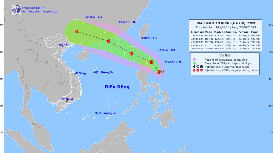
At 04am on August 25, Maon was churning around the northern part of the East Sea, about 290km east of China’s Leizhou island, packing winds of 117kph near its centre.
The storm is forecast to travel west and north-west at a speed of 25kph and pound China’s Guangdong province in the coming hours.
After making the landfall, Maon is anticipated to lose strength into tropical low depression, but to cause heavy rain in northern localities of Vietnam.
Rain started in a number of northern localities, including the capital of Hanoi, on August 25 morning. Torrential rain is expected to dump coastal and low-lying areas in the evening and the following day.
Weather experts warned about possible flashfloods and landslides in mountainous areas.
Maon is the third storm that has formed in the East Sea and the second that has struck Vietnam this year.