Minor earthquakes shake central Vietnam’s Quang Ngai province

VOV.VN - Two minor earthquakes measuring 3.6 and 2.8 on the Richter scale struck central Quang Ngai province on March 21, causing light tremors across several localities, according to the Earthquake Information and Tsunami Warning Centre under the Institute of Earth Sciences.

The stronger quake, with a magnitude of 3.6, occurred at 6:21:36 p.m. (Hanoi time) at a depth of about 8 km, with its epicenter located in Mang But commune. The disaster risk level was assessed at zero.
Tremors were felt not only in areas near the epicenter such as Son Tay, Ba To and Son Ha communes, but also in eastern communes including Duc Pho, Nghia Hanh and coastal areas like My Khe and Dung Quat, up to around 80 km away. Residents reported the shaking lasted approximately three seconds.
Earlier the same day, at 2:16:32 p.m., another smaller earthquake measuring 2.8 struck at the same location. Authorities are continuing to monitor seismic activity in the area.
After a relatively quiet period, the Mang Den–Mang But area has seen a renewed increase in seismic activity. This region, former part of Kon Plong district in Kon Tum province, has been identified as a seismic hotspot in Vietnam over the past five years.
According to scientists, the earthquakes in this area are classified as induced seismicity, often linked to water accumulation in hydropower reservoirs, which can accelerate geological activity compared to natural cycles.
Experts noted that seismic activity is likely to continue, but the probability of earthquakes exceeding magnitude 5.0 remains low. The strongest recorded quake in the area, measuring around 5.0, occurred on July 28, 2024 and caused tremors across a wide region.
Since 2021, more than 1,000 earthquakes have been recorded in the Kon Plong area. Scientists consider this a low-intensity seismic zone, with most tremors associated with reservoir-induced pressure on underground fault lines.
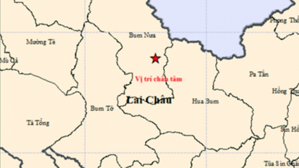
Minor earthquake recorded in Lai Chau, no damage or casualties reported
VOV.VN - A minor earthquake was recorded in Lai Chau province in northern Vietnam on the morning of March 20, with no casualties or damage reported.


