Typhoon Kompasu brings heavy downpours to northern and central regions

VOV.VN - Typhoon Kompasu, with winds speed reaching up to 120km per hour at its eye, is currently heading towards northcentral provinces, causing heavy rainfall to hit localities from Thanh Hoa to Quang Tri, according to the National Centre for Hydro-meteorological Forecasting.

This comes after the typhoon was located approximately 260km northeast of the Hoang Sa (Paracels) archipelago and roughly 280km east of China’s Hainan Island 7 am on October 13.
Over the course of the following 24 hours, the typhoon is forecast to quickly move west at a speed of between 25km and 30km per hour before entering the southern waters of the Gulf of Tonkin where it is likely to gradually weaken.
At 7 am on October 14 the eye of the storm was roughly 190km, 170km, and 140km from Thanh Hoa, Nghe An, and Quang Binh, respectively, with the strongest winds near its centre reaching between 75km and 90km per hour.
During the next 36 hours, the storm is projected to keep moving in a western direction at a speed of about 20km per hour.
Mai Van Khiem, director of the National Centre for Hydro-meteorological Forecasting, said due to the impact of cold air, the storm is anticipated to decrease in intensity when entering China’s Hainan Islands.
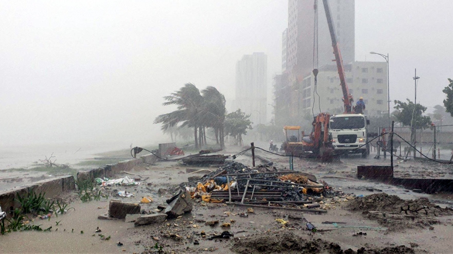
It is forecast to make landfall in areas from Thanh Hoa to Quang Binh on the morning of October 14 before it weakens into a tropical depression, said Khiem, adding that there will be strong winds in the coastal area from Quang Ninh to Quang Binh from October 13 to October 14.
Furthermore, strong winds and high waves are set to be recorded in the northern East Sea area, the Gulf of Tonkin, and coastal areas from Quang Tri to Quang Ngai.
Flooding and high tides are also forecast to occur in low-lying areas from Thai Binh to Ha Tinh on the morning of October 14.
From October 13 to October 15, torrential rain is likely to hit the northern region and Quang Tri, with rainfall in some areas reaching between 100mm and 200mm.
Localities from Thanh Hoa to Quang Binh have therefore been put on alert for high risk of flash floods, and landslides in mountainous areas along with low-lying and riverside areas.
From October 16, due to the influence of cold air intensification combined with the tropical convergence band, heavy downpours will continue to take place throughout the central region.
Provinces in the northern and central region have been told to arrange anchorage for vessels and devise evacuation plans for local residents, many of whom live in areas at high risk of flash floods and landslides, to a safe place.