Typhoon Kajiki unusual as it makes landfall within three days

VOV.VN - Typhoon Kajiki has been described as highly unusual as it formed directly over the East Sea (South China Sea) and made landfall within just three days, half the usual duration, according to Deputy Minister of Agriculture and Environment Nguyen Hoang Hiep.

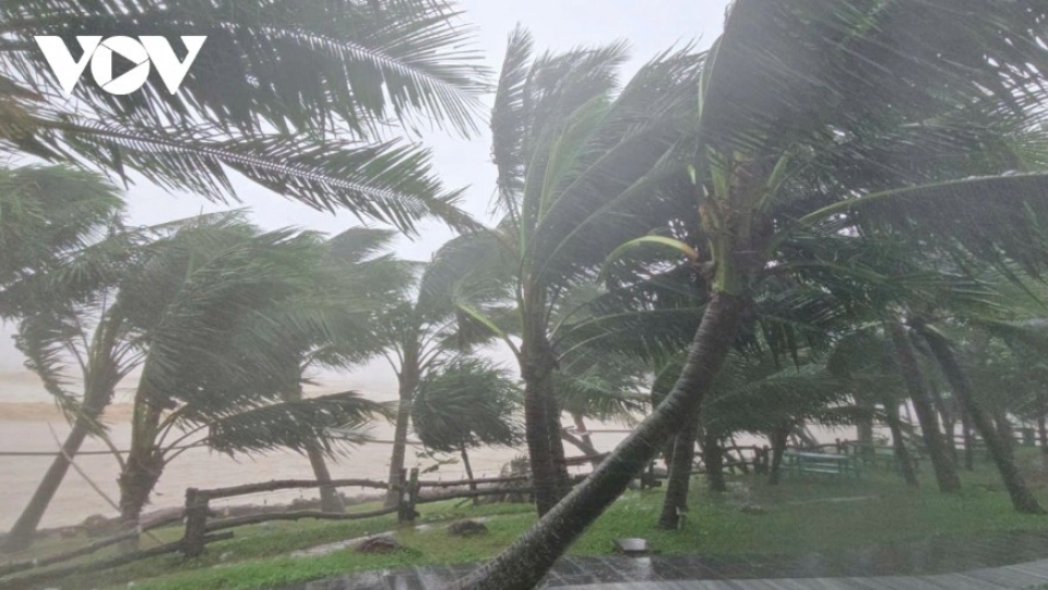
The storm stalled for nearly two hours before landfall, creating the impression that it had dissipated. Without timely updates, this could have led to public complacency. Upon landfall in central Ha Tinh province, wind speeds reached level 10, with gusts of levels 12-13. As of late August 25, the storm remained over Nghe An province and was expected to linger until midnight, posing a very high risk of flash floods and severe flooding.
According to the National Center for Hydro-Meteorological Forecasting, as of 10 p.m. on August 25, Typhoon Kajiki was located inland between southern Nghe An and northern Ha Tinh, packing maximum sustained winds of levels 9-10 (75-102 km/h) and gusts up to level 12. In the next three hours, it is forecast to move further inland on a west-northwest track at around 15 km/h and gradually weaken.
During the past 21 hours (from midnight to 9 p.m. on August 25), provinces including Phu Tho, Quang Ninh, and the stretch from Thanh Hoa to Quang Tri experienced moderate to heavy rainfall, with some areas seeing torrential downpours.
Authorities warn that in the next six hours, flash floods may occur in small rivers and streams, with landslides on steep slopes in multiple localities. Disaster risk warnings for flash floods, landslides, and subsidence due to heavy rain and runoff are at Level 1; however, for Ha Tinh, Thanh Hoa, and Nghe An, the warning level has been raised to level 2.

Flash floods and landslides are likely to severely damage the environment, endanger lives, disrupt local traffic, and destroy residential, economic, and agricultural infrastructure. Local authorities have been urged to review vulnerable areas, bottlenecks in waterways, and other at-risk sites to take preventive measures.
Nine reported dead or injured so far
Preliminary statistics show that as of 6 p.m. on August 25, Typhoon Kajiki left one person dead in Ha Tinh and injured eight others (four in Ha Tinh and four in Quang Tri).
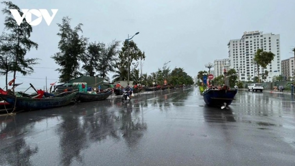
In terms of property damage, 621 houses lost roofs, and 144 homes were flooded in Ha Tinh. More than 16,000 hectares of rice fields, 611 hectares of vegetables, and 2,058 hectares of fruit trees were damaged, while over 4,400 roadside trees were knocked down. About 13 hectares of aquaculture ponds were submerged. Transportation was disrupted by three landslides in Quang Tri and widespread localized flooding. In Ha Tinh, 22 electricity poles were toppled.
Local authorities are currently carrying out immediate response and recovery efforts while continuing to assess total damages. Functional agencies are closely monitoring rainfall, floods, and tides, and have urged residents to remain vigilant, avoid complacency, and refrain from traveling through flood-prone or landslide-affected areas.
Due to the impact of Typhoon Kajiki, Deputy Prime Minister Tran Hong Ha has instructed Nghe An province to continue controlling the movement of residents and vehicles on roads until the morning of August 26, allowing travel only when safety conditions are fully met.
Typhoon Kajiki weakens after landfall, slows in past three hours
VOV.VN - Typhoon Kajiki remained nearly stationary over the past three hours and weakened to level 12, with gusts up to level 14, the National Center for Hydro-Meteorological Forecasting reported on the afternoon of August 25.
Powerful Typhoon Kajiki nears central Vietnam, 180 km off Quang Tri
VOV.VN - Typhoon Kajiki, the fifth storm to hit Vietnam this year, was located about 180 km off central Quang Tri province early on August 25, with maximum sustained winds of level 14 (150-166 km/h) and gusts reaching level 17.
