Tropical storm gains strength, heads toward Vietnam

VOV.VN - A tropical storm has formed in the East Sea and is forecast to pick up forward speed before making landfall in Vietnam in a couple of days, according to the national weather authority (NCHF).

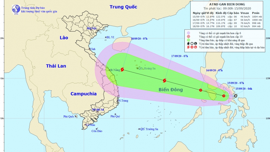
At around 4am September 16, storm Noul was located about 200km north of Palawan island of the Philippines, packing gusts of between 60-75kph near its centre.
In the next 24 to 48 hours, the storm is moving west and north-west at a speed of between 15-20kph and is likely to gain strength.
It will continue to intensify as it makes its way toward central Vietnam, travelling at a speed of between 20-25kph.
Noul will cause rough seas and heavy rain on the way it traverses Vietnam’s Hoang Sa (Paracel) archipelago in the East Sea.
Central coastal provinces of Vietnam, especially those spanning from Quang Binh to Da Nang, are on high alert as the storm is approaching the coast. Mountainous localities are warned about possible flashfloods and landslides when it makes landfall this weekend.
Noul is forecast to be the most powerful storm that has formed in the East Sea this year, according to weather experts.