Toraji weakens further, central Vietnam endures heavy rain
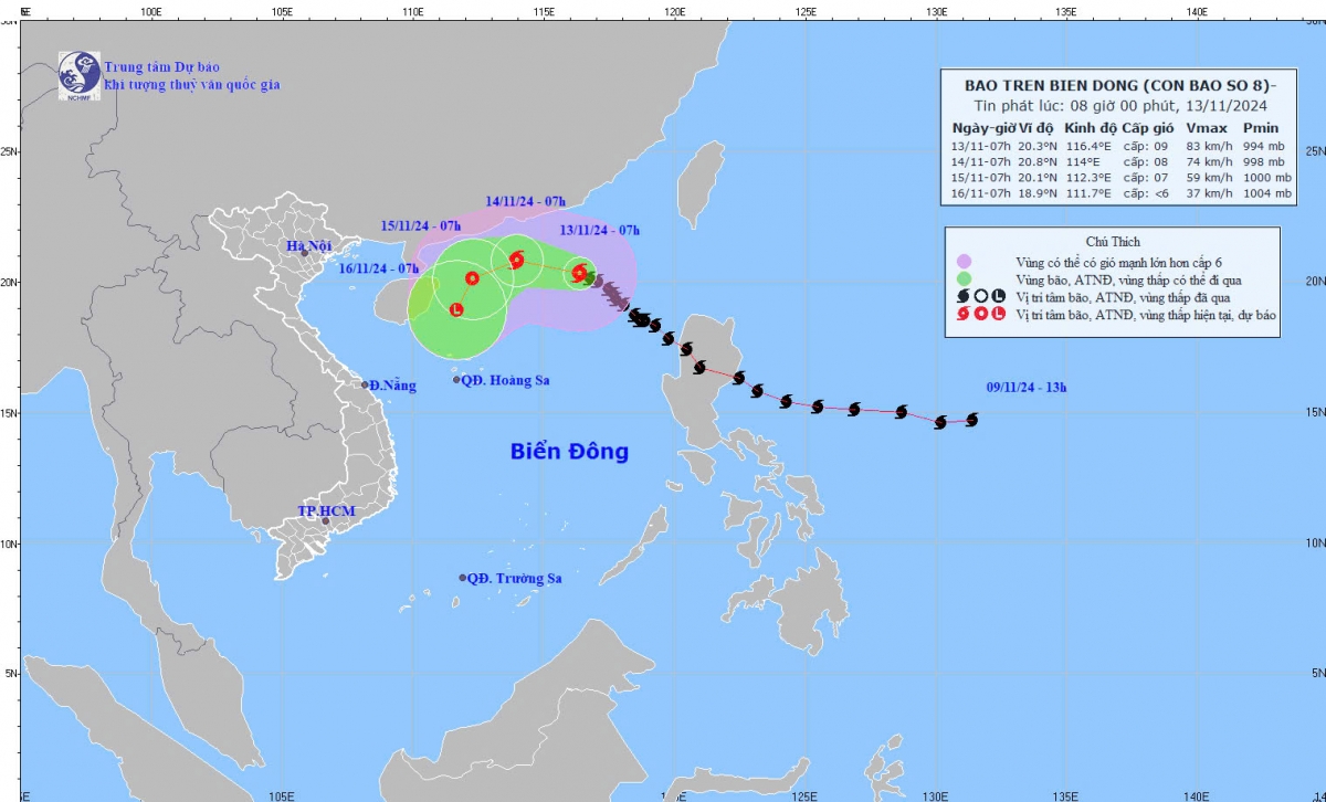
VOV.VN - Typhoon Toraji, has continued to lose its strength as it is moving towards the central region of Vietnam, causing a spell of heavy rain for a couple of days.

One day after entering the East Sea, Toraji, the 8th storm the year in the region, has been downgraded, with gale-force winds falling from more than 100kph to around 90kph and is forecast to keep weakening in the coming days.
At 7a.m. on November 13, Toraji was located in the northeastern part of the East Sea, packing winds of 62 – 75kph near its centre.
In the next 24 hours, the storm is forecast to sustain its west-northwestern direction in the northern part of the East Sea and further lose its strength into a tropical depression.
The Ministry of Agriculture and Rural Development on November 12 issued an urgent directive requiring the coastal provinces from Quang Ninh to Binh Dinh to closely monitor the storm’s developments, notify vessels of dangerous areas to help them return to safe shelter, and be prepared with rescue and relief teams in case of emergency.
Meanwhile, the tropical depression, which has weakened from Typhoon Yinxing, continued to lose its force into a low pressure and dissipated after churning across the coastal provinces from Quang Ngai to Phu Yen.
In the past 24 hours, moderate to heavy rainfall, including heavy downpour, battered provinces from Thua Thien-Hue to Binh Dinh and Gia Lai. Some localities received high amounts of rainfall, including Huong Phu 122 mm; Ba Na 272.6 mm; Phuoc Ninh 154.4 mm; Pho Phong 308 mm; Tay Thuan 189.2 mm; and Dak To Pang 189.2 mm.
Soil moisture models indicate that some areas in these provinces are nearing or have already reached saturated conditions. There is a very high risk of flash floods and landslides in these areas, warned meteorologists.


