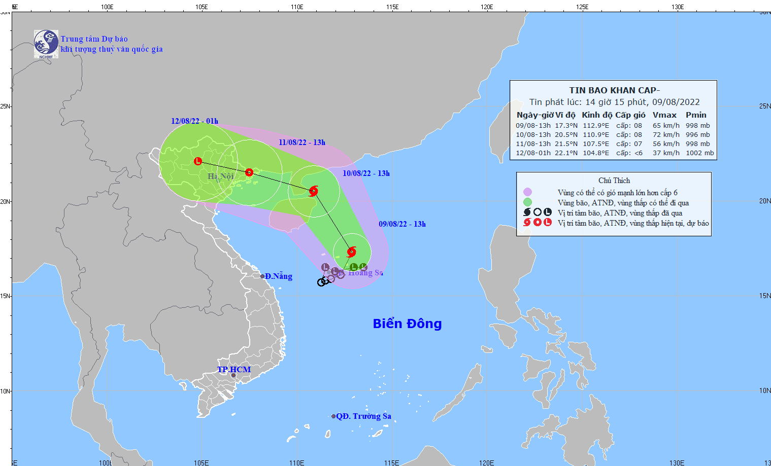
Storm MULAN heads toward northern Vietnam
VOV.VN - A tropical low depression on August 9 strengthened into a tropical storm named MULAN which is travelling towards the northern coast of Vietnam, according to the National Center for Hydrometeorological Forecasting.

At 01pm on August 9, MULAN was located nar the northern part of the Hoang Sa archipelago of Vietnam, approximately 300km south east of China’s Hainan island. It was packing winds of between 62 and 74kph nears its eye.
In the next 24 hours, the storm is forecast to move north and change its course into north-west at a speed of 15-20kph.
In the next 24 to 48 hours, the storm is anticipated to travel west and north-west at a speed of 15kph and weaken into a tropical low depression.
Northern provinces, especially those stretching along the coastal areas, have been warned about heavy rain and rough seas in the coming days.
This is the second tropical storm that has formed in the East Sea this year.


