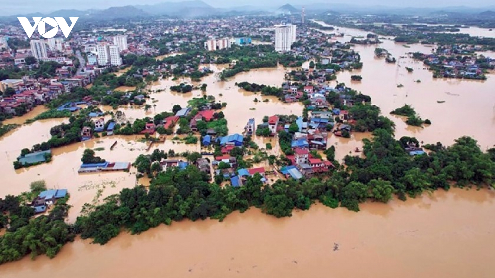
Heavy rain triggers landslides, flooding across Central Vietnam

VOV.VN - Central Vietnam is facing widespread landslides and flooding after several days of torrential rain, with Hue, Da Nang, and Quang Ngai among the hardest-hit localities.

Authorities have issued emergency alerts as rainfall continues to intensify due to the combined effects of a cold air surge, strong easterly winds, and an active tropical convergence zone.
Heavy downpours from the night of October 25 to the morning of October 26 pounded the central region, triggering landslides that blocked major roads and isolated mountain communities in Da Nang.
According to the Central Region Hydro-Meteorological Station, rainfall in mountainous areas reached exceptionally high levels, with Nam Tra My recording dozens of landslide-prone locations. A major slide on the inter-commune road from Tra Tap Police Station to the old Tra Cang commune cut off local traffic.
Another large-scale landslide occurred on National Highway 40B near the Five-Tier Waterfall, sending tonnes of soil and rocks tumbling down. Authorities have urged residents to avoid affected areas until rescue and road-clearing operations restore safe passage.
Further south, National Highway 14E was paralysed after mud, rocks, and fallen trees swept onto the roadway in Hiep Duc commune, despite previous reinforcement works in September.
Water levels at major hydropower reservoirs - Song Tranh 2, Dak Mi 4, and A Vuong - have also surged by up to two meters within 24 hours, prompting controlled discharges to ensure downstream safety.
In Hue city, continuous heavy rain, ranging from 30 to 100 mm overnight, caused severe erosion along coastal areas. In Phu Loc commune, powerful waves damaged sea embankments and roads in Tan An Hai village, collapsing a 30-meter section of rock gabion walls and creating deep cavities along the coast.
The Hue City People’s Committee has declared a state of emergency, directing immediate reinforcement and relocation efforts to safeguard residents.
Forecasts warn that rainfall will persist through October 28, with total precipitation expected to reach 200–400 mm, and in some places exceeding 600 mm. Prolonged rain raises the risk of flashfloods, rockslides, and urban inundation, especially in mountainous areas like A Luoi, Nam Dong, Phong Dien, and Phu Loc.
In Quang Ngai province, multiple landslides along the Ho Chi Minh Highway have disrupted traffic. Around 10:10 a.m. on October 26, a 200-cubic-meter landslide occurred in Dak Pek commune, blocking the road. Earlier the same morning, two slides at sections Km1411+400 and Km1411+500 caused temporary gridlock for nearly 20 minutes.
Local maintenance teams have partially cleared the debris, reopening one lane while continuing full cleanup operations. Meanwhile, rivers across Quang Ngai remain below alarm level 1, but rising water is being closely monitored.
According to the National Centre for Hydro-Meteorological Forecasting (NCHMF), the ongoing extreme weather is caused by a combination of the ongoing cold air surge from the north, the upper-level easterly wind disturbances, and an active intertropical convergence zone
Meteorologists say the central region’s narrow topography, bounded by mountains and the sea, exacerbates the situation. Moist air from the sea is trapped and forced upward along the eastern slopes of the Truong Son Mountain Range, resulting in intense orographic rainfall.
With the rainy season peaking in late October, experts warn that this heavy rain episode may continue through the end of the month, posing heightened risks of flooding, landslides, and infrastructure damage.

Cold air weakens storm but triggers heavy rain across central Vietnam
VOV.VN - Storm Fengshen is forecast to make landfall between central Da Nang and Quang Ngai provinces on October 23 with sustained winds of level 6 (39-49 km/h) and gusts of level 8 (62-74 km/h).