Extreme weather to persist in Vietnam, authorities warn of more storms ahead

VOV.VN - From now until the end of 2025, the number of storms and tropical depressions in the East Sea is expected to be higher than the multi-year average, while cold air fronts are forecast to increase in both intensity and frequency from October, earlier than usual, according to the Department of Hydrometeorology.

Natural disasters in the first nine months of 2025 have shown abnormal, complex, and increasingly extreme patterns compared to previous years, said Hoang Duc Cuong, deputy director of the Department of Hydrometeorology, at a press briefing in Hanoi on October 6.
The northern, north-central, and central coastal regions of Vietnam have been severely affected, with disasters occurring outside of typical seasons, intensifying in severity, and impacting larger areas, he said.
By the end of September, 11 storms and four tropical depressions had formed over the East Sea, significantly higher than average, with six directly or indirectly affecting Vietnam. Notably, Super Typhoon Ragasa that battered Vietnam on September 25 reached wind speeds of more than 200km/h, making it the strongest storm ever recorded in the East Sea. Although it weakened before landfall, it underscored the growing threat of super typhoons amid climate change.
Few days later, Typhoon Bualoi made direct landfall across central Vietnam, bringing widespread torrential rain of 300–600 mm, strong winds, and triggering large-scale flooding, landslides, and flashfloods from the northern to central regions. This was one of the most anomalous and extreme storms observed.
Since the beginning of the year, Vietnam has experienced 14 widespread heavy rain events, including two rare out-of-season occurrences in May and June. Two particularly destructive storm systems - Typhoons Kajiki and Ragasa - caused overlapping natural disasters within just a month.
Looking ahead, the agency forecast that extreme weather patterns would persist in the remaining months of the year. From October to December 2025, storm activity in the East Sea will likely be above average, with 4–5 storms expected, including 2–3 that may directly impact Vietnam. The ENSO phenomenon is projected to remain in a neutral state, leaning toward a La Nina-like pattern, though not yet reaching full La Nina conditions.
Cold air fronts are anticipated to strengthen from November through December, with the first cold spell likely to hit northern Vietnam in the second half of December, roughly in line with historical averages.
From now until the end of the year, central Vietnam is likely to face more spells of heavy rain. The peak of the storm and flood season is expected to hit the area from Ha Tinh to Hue, and the eastern parts of provinces from Quang Ngai to Khanh Hoa between October and mid-December.
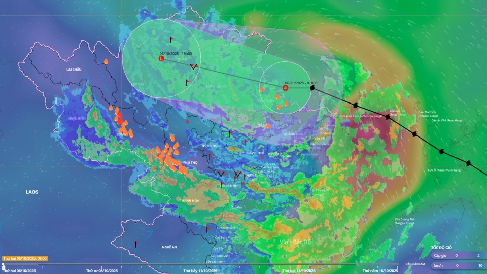
Typhoon Matmo makes landfall, heavy rain forecast for Northern Vietnam
VOV.VN - Typhoon Matmo made landfall in the Fangcheng area of China’s Guangxi province, near the Vietnam–China border on October 6, before weakening into a tropical depression as it moved deeper into the northern mountainous regions of Vietnam.


