HCM City launches Vietnam’s first cross-sea UAV delivery route

VOV.VN - Ho Chi Minh City on February 12 launched the country’s first cross-sea postal delivery route using unmanned aerial vehicles (UAVs), connecting Can Gio and Vung Tau in a pilot initiative aimed at advancing smart logistics and the low-altitude digital economy.

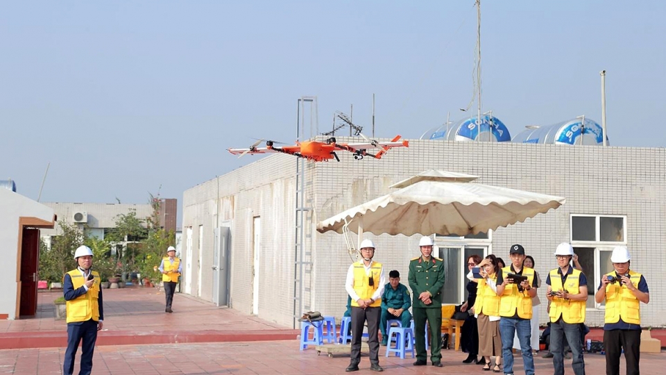
The service was inaugurated at Can Gio Ferry Terminal in coordination with the municipal Department of Science and Technology, Vietnam Post, and CT UAV Joint Stock Company.
At the launch ceremony, a live demonstration flight transported a parcel from Can Gio to Vung Tau. The entire process, from loading and takeoff to sea crossing, landing and handover, was carried out safely. The route links the Can Gio ferry terminal with the Vung Tau sea ferry terminal on Tran Phu Street.
The project is considered a pioneering step in applying intelligent transport solutions, helping reduce pressure on road infrastructure while contributing to the city’s digital economy index. It also marks the establishment of Vietnam’s first unmanned cross-sea postal corridor.
Vietnam Post serves as the lead service operator, responsible for designing operational procedures, quality standards and parcel handling processes. All shipments are integrated into its logistics management system, ensuring what the company describes as a “one code – one journey” experience for customers.

During the initial phase, the service prioritises small parcels under five kilograms, including documents and e-commerce packages.
The Department of Science and Technology acts as the overall coordinating agency, working with the Ho Chi Minh City High Command to supervise daily operations following the launch.
Officials said the UAV delivery route significantly shortens transport time between two geographically distinctive localities while providing customers with real-time tracking and faster delivery options. The model is also expected to enhance service capacity in cases of traffic disruption.
Beyond its logistics function, the pilot project is designed to generate operational data to help regulators refine policies related to smart logistics and low-altitude economic development.
According to the municipal Department of Science and Technology, the deployment of UAVs in logistics represents not merely a technological experiment but a demonstration of the city’s commitment to fostering an innovation-driven ecosystem. The initiative also opens opportunities for domestic technology enterprises to master advanced aerial vehicle production and operation.
In the longer term, authorities said the technical platform and operational experience gained from the Can Gio–Vung Tau route could be expanded to other fields, including search and rescue missions, public administration support and medical assistance in remote areas.
The project’s broader goal is to build public confidence that advanced technology can serve daily life in a safe, efficient and sustainable manner.
Vietnam launches first UAV pilot for medical transport
VOV.VN - Hanoi-based Duc Giang General Hospital, in collaboration with Vietnam Post, launched a pilot programme using unmanned aerial vehicles (UAVs) to transport medical specimens, medicines and supplies, on December 25.

