Low depression to strengthen into storm, head towards central Vietnam
VOV.VN - A tropical low depression is likely to strengthen into a storm and strike Vietnam’s central coastal localities in the next two days, according to the National Centre for Hydro-Meteorological Forecasting (NCHMF).

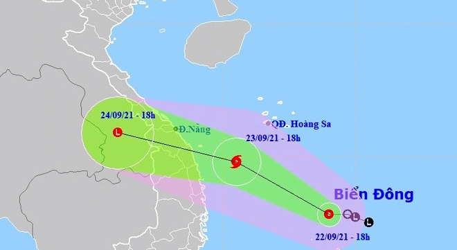
At 06pm on September 22, the tropical low depression was about 180km north-east of Vietnam’s Song Tu Tay island, packing winds of 80kmph near its centre.
In the next 12 hours, the tropical low depression is forecast to gain strength into a storm, moving north and north-west at a speed of 15-20kph.
In the next 24-48 hours, the storm is anticipated to maintain its direction and speed and pound central coastal localities from Thua Thien-Hue to Binh Dinh before weakening into a low depression and dissipating in southern Laos.
The storm will cause rough seas and bring heavy rain to the central coastal region. Rainfall of 150-250 mm is possible over much of the region, but higher amounts of 300mm or more are likely for the Central Highlands and north-central regions.
Water can quickly pond in low-lying areas, while higher elevation areas are susceptible to mudslides during heavy rainfall.

