Typhoon Koto moves slowly in East Sea, rare tropical depression forms near Malaysia
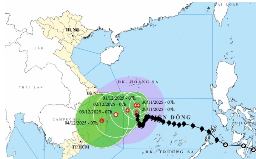
VOV.VN - On the morning of November 29, the center of typhoon Koto (Storm No. 15 of 2025 in Vietnam) was located in the northwestern part of the central East Sea. Maximum sustained winds near the center reached force 9-10 (75-102 km/h), with gusts up to level 13, according to the National Center for Hydro-Meteorological Forecasting (NCHMF).

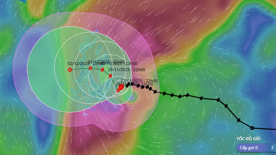
The typhoon is moving north at around 5 km/h. Forecasts indicate that over the next 24 hours, by 10 a.m. on November 30, the typhoon will continue moving north at a reduced speed of about 3 km/h. Its center will remain in the northwestern part of the central East Sea, approximately 310 km off the eastern coast of Gia Lai – Dak Lak provinces.
Wind intensity will maintain at force 9-10 (75-102 km/h), with gusts reaching level 13, posing level-3 maritime disaster risk for the northwestern central East Sea.
By 10 a.m. on December 1, the typhoon is expected to shift westward and weaken slightly, moving at about 2 km/h. Its position and distance from the coast will remain largely unchanged, about 310 km east of Gia Lai – Dak Lak. Wind intensity will drop to force 9-10 (75-102 km/h), with gusts up to level 13.
By 10 a.m. on December 2, the typhoon will turn southwest at 3-5 km/h, positioned in the northwestern central East Sea, approximately 250 km east of Gia Lai – Dak Lak. Wind intensity will weaken to force 8 (62-74 km/h), with gusts reaching level 10.
Over the following 72-120 hours, the typhoon is forecast to move slowly west-southwest at around 5 km/h and continue weakening. Rough seas are expected, and vessels are urged to avoid dangerous areas.
In the northwestern central East Sea, winds reach force 7-8 (50-61 km/h), increasing to force 9-10 (75-102 km/h) near the typhoon center, with gusts of 12-13.
Sea waves are 3-5 m high, reaching 6–8 m near the center, causing very rough conditions. Offshore areas from Gia Lai to Khanh Hoa provinces also report winds of force 6-7 (39-49 km/h), increasing to force 8 (50-61 km/h) with gusts of 9-10, and waves of 4-6 m. Vessels operating in these areas are advised to seek shelter immediately and avoid danger zones due to possible thunderstorms, whirlwinds, strong winds, and high waves.
Rare tropical depression forms near Malaysia
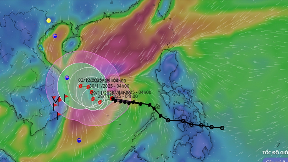
On the afternoon of November 28, a tropical depression formed near Malaysia and is expected to move into the East Sea in the coming hours. NCHMF Director Mai Van Khiem said this is an extremely rare weather phenomenon, possibly unprecedented.

“Besides Typhoon Koto in the central East Sea, a tropical depression formed on the eastern waters of Malaysia on the afternoon of November 28. This system originated from Typhoon Senyar, moving from the Indian Ocean across Malaysia into the northwestern Pacific,” he said.
Forecasts indicate the depression may move into the southwestern part of the southern East Sea by the morning or midday of November 29.
“Since 1951, a few tropical depressions have formed at latitudes below 5.0°N. However, most of these moved westward rather than eastward. Therefore, a depression forming at low latitude and moving eastward, as currently observed near eastern Malaysia, is extremely rare, possibly unprecedented. However, its likelihood of directly impacting the southern mainland is low,” Director Khiem analyzed.
Experts note that the depression’s circulation mainly causes strong winds over the western waters of the southern East Sea, including western Spratly waters and eastern waters from Lam Dong to Ca Mau provinces, with winds of force 6-7 (39-49 km/h), gusts up to level 8, and waves of 2.5-4.0 m.
Maritime authorities advise vessels operating in these areas to exercise caution due to potential thunderstorms, whirlwinds, strong winds, and high waves.


