Tropical low depression moves closer, heavy rain expected

VOV.VN - A tropical low depression is moving closer to the Gulf of Tonkin and is anticipated to gain strength and affect Vietnam’s northern coast in coming hours.

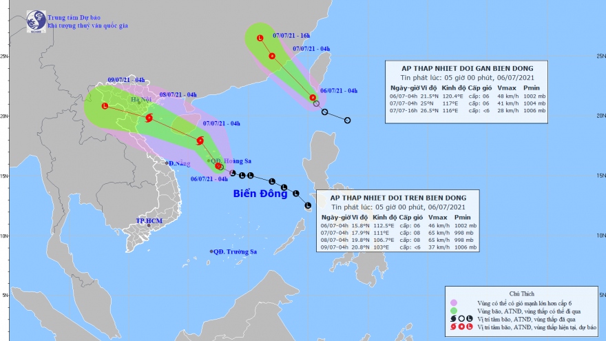
At 10.00am on July 7 the depression was swirling around China’s Hainan island with winds gusting 70kph near its centre, said the National Centre for Hydrometeorology Forecasting.
In the next 12 hours it will head closer toward the northern and north-central coasts from Thai Binh to Nghe An provinces, travelling at a speed of 25-30kph.
It will pound the northern and north-central provinces early on July 8 before moving further inland and dissipating on the Vietnam – Laos border.
The tropical low depression is forecast to dump heavy rain in excess of 250-300mm on the northern and north-central deltas from Hoa Binh to Nghe An provinces.
Meteorologists warned about whirlwinds, floods and landslides in mountainous areas over two days.
Between 10 and 12 storms and tropical depressions are anticipated to hit the East Sea this year, with roughly half expected to directly impact the Vietnamese mainland, mostly in the fourth quarter.